


Drone Inspection and Surveying Services in Gyumri
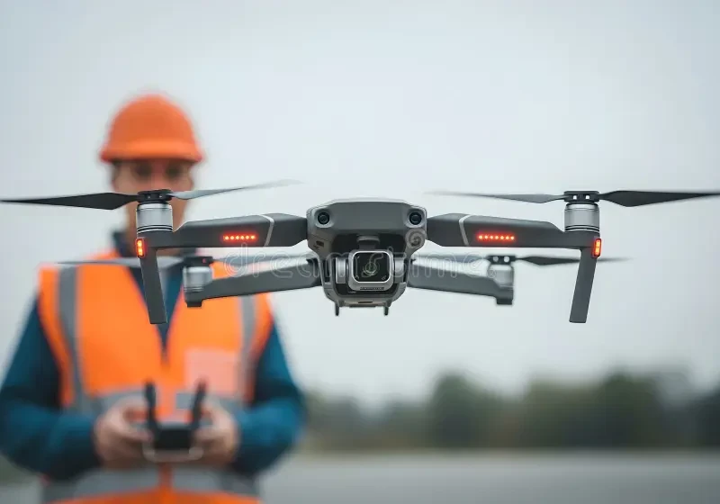
Drone services can document difficult-to-reach building areas, create an aerial record of a site or collect overlapping images for mapping and three-dimensional modelling. The correct method depends on how the result will be used. On Turn.am, you can review providers serving Gyumri, compare their equipment and deliverables, and contact them directly with a project brief.
Visual inspection, mapping and surveying are not the same
A visual inspection records roofs, facades, gutters, chimneys, towers, solar panels or other assets from useful viewpoints. It may reveal visible cracks, displaced elements, staining or surface damage, but imagery alone does not establish the cause or structural significance. An engineer or another suitably qualified specialist may need to interpret the findings and decide whether close inspection or testing is required.
Photogrammetric mapping uses planned, overlapping photographs to produce outputs such as an orthomosaic, point cloud, surface model, contours, volume calculation or textured 3D model. Aerial photos or a promotional video are not automatically survey-grade data. If measurements will support design, payment, cadastral work or another formal purpose, define the required coordinate system, accuracy, verification and professional sign-off before the flight.
Define the question before choosing equipment
Tell the provider whether you need condition evidence, measurements, construction progress, stockpile volumes, a base map, thermal screening or presentation media. One mission can sometimes serve several goals, but each requires suitable viewpoints, image overlap, resolution and quality checks.
- Roof and facade inspection: numbered photographs, location references and annotated observations.
- Site mapping: georeferenced orthomosaic, point cloud or elevation products in agreed formats.
- Progress records: repeatable flights using a consistent area, reference system and comparison method.
- Volume calculations: a defined boundary, defensible base surface and documented limitations.
- Thermal screening: radiometric data and recorded environmental conditions when quantitative review is required.
Accuracy must be specified and verified
Image resolution is not the same as positional accuracy. The result also depends on camera calibration, flight geometry, image sharpness, surface texture, coordinate control and processing. Ground control points can connect a model to surveyed coordinates, while independent checkpoints help verify the result. RTK or PPK positioning may improve camera locations, but it does not automatically prove that the final model meets every project tolerance.
Ask the provider to state the proposed coordinate reference, horizontal and vertical accuracy, ground sampling distance, control method and quality report. Reflective surfaces, uniform areas, vegetation, water, thin objects and moving equipment may reconstruct poorly and should be identified as limitations rather than presented as exact geometry.
Thermal drone inspection has limits
A thermal camera records infrared radiation from visible surfaces. Apparent temperature patterns are affected by material emissivity, reflection, viewing angle, distance, focus, sunlight, wind, moisture and the thermal condition of the asset. A coloured thermal image does not by itself prove missing insulation, hidden moisture or an electrical defect.
Agree on the inspection conditions, capture time, required file type and who will interpret the data. Quantitative work may require original radiometric files rather than screenshots. Suspected anomalies often need confirmation through close inspection, moisture measurement, electrical testing or another appropriate method.
Flight permissions, site safety and privacy
The operator should check the current Armenian aviation requirements and any restrictions applicable to the precise site and planned operation. Property-owner consent does not replace any required aviation authorization, and permission to fly does not remove obligations concerning people, neighbouring property, privacy or workplace safety. Requirements can change, so approval should be confirmed for the actual date and mission.
A safe plan identifies takeoff and landing areas, nearby people and traffic, obstacles, overhead lines, emergency actions and weather limits. For an occupied property or active construction site, agree on access control and a responsible site contact. Capture only the material needed for the assignment, define who may access raw imagery and do not use inspection footage for marketing without appropriate permission.
Deliverables to agree in writing
For inspection work, specify the areas to be covered, minimum image detail, original files, annotations, defect numbering, capture date and limitations. For mapping, state the coordinate system, units, orthomosaic resolution, point-cloud or mesh format, elevation model, contours, CAD or GIS exports, control report and accuracy statement. Confirm whether raw photographs and processing files are included.
Software compatibility and long-term access matter. A web viewer may be convenient, but it should not be the only copy when files must be archived or transferred to another specialist. If the output may support a claim or future comparison, preserve original files and relevant metadata without undocumented alteration.
What affects the price
Cost depends on the site area, number of assets, flight complexity, permissions, ground-control survey, sensor type, required resolution, repeat visits, processing depth, file formats and whether specialist interpretation is included. Weather or site access may affect scheduling. Compare proposals with the same scope: unreferenced photographs are not equivalent to a verified mapping product or an engineering report.
What to send when requesting a quote
Provide the exact location, site boundaries, asset type, purpose of the work, approximate area or number of structures, required deadline and examples of expected outputs. Mention access restrictions, operating hours, people or machinery on site, known obstacles and any existing drawings or coordinate data. Ask the provider to separate flight, control survey, processing and professional interpretation in the estimate.
Before booking, confirm who operates the drone, who is responsible for surveying or engineering conclusions, which permissions are handled, how weather postponements work and how the result will be checked. A useful proposal connects every flight and file to the decision your project needs to make.