


Drone Inspection and Aerial Surveying Services in Vanadzor
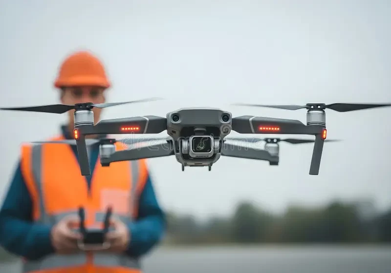
A drone assignment should begin with the decision the collected data needs to support. Detailed roof photographs, a construction progress record, a georeferenced site map and a measured 3D model are different products, even when they use the same aircraft. On Turn.am, you can find providers serving Vanadzor, compare their proposed methods and contact them directly with the location and required outputs.
Turn a general request into a useful brief
“Drone survey” can mean anything from a short visual flight to controlled photogrammetry. Explain the asset or area, the problem being investigated, how the result will be used and who will receive it. An engineer may need traceable defect photographs; a designer may need CAD-compatible coordinates; a contractor may need comparable dated models; a property owner may only need a clear overview.
Provide site boundaries, existing drawings, known hazards, access times and a realistic deadline. If measurement matters, state the coordinate system, units, scale or allowable error required by the receiving professional. The provider should confirm what can and cannot be concluded from the proposed capture.
Common outputs from drone work
- Building inspection imagery: overview and close oblique photographs of roofs, facades, drainage, towers or equipment, organized by location.
- Orthomosaic: a corrected aerial image assembled from overlapping photographs and, when required, tied to coordinates.
- Point cloud and 3D model: digital representations of visible surfaces for viewing, measurement or design support.
- Elevation products: surface models and contours produced to an agreed reference and tolerance.
- Progress documentation: repeat flights with consistent coverage and naming for comparison over time.
- Volume calculation: measurements based on a defined object boundary and base surface.
A smooth-looking model is not evidence of survey accuracy. Promotional video may be added to a project, but it does not replace controlled data capture.
Inspection evidence is not an engineering diagnosis
Drone photographs can show visible openings, deformation, corrosion, displaced roof elements, damaged finishes or blocked drainage. They generally cannot reveal what lies beneath an opaque surface, test material strength or determine why a crack developed. The report should separate observable features from interpretation.
If the assignment concerns structural safety, electrical equipment, conservation, geotechnical conditions or another specialist subject, clarify who is professionally responsible for the conclusion. The pilot may collect the evidence while an appropriately qualified specialist reviews it and recommends close access, testing or monitoring where needed.
How mapping quality is demonstrated
Useful measurement quality depends on more than camera megapixels. Flight geometry, overlap, shutter settings, focus, surface texture, coordinate control and processing all affect the result. Ground control points may be used to align the model with surveyed coordinates, while separate checkpoints help test the achieved accuracy.
RTK or PPK positioning can improve recorded camera locations but does not remove the need to verify the final output against the project specification. Ask for an accuracy statement that identifies the reference system, control method, checkpoint results and known weak areas. Water, glass, reflective roofs, vegetation, wires and moving objects may not reconstruct reliably.
Thermal inspection requires suitable conditions
A thermal sensor records infrared radiation from visible surfaces and displays apparent temperature differences. Those patterns are influenced by emissivity, reflection, distance, angle, sunlight, wind, moisture and the operating condition of the asset. A thermal anomaly can guide further investigation, but it does not by itself prove a roof leak, insulation failure or electrical fault.
Agree on environmental requirements, capture timing, visible reference photographs and file format before the visit. Quantitative interpretation may require original radiometric data. Any suspected defect should be confirmed with an appropriate close inspection or test.
Feasibility, aviation rules and site control
Before promising a flight, the operator should check the current Armenian aviation requirements and restrictions for the exact location, aircraft and operation. Landowner approval is important but does not substitute for any required aviation authorization. Requirements and temporary limitations can change, so a previous flight at the site is not automatic permission for a new one.
The site plan should address takeoff and landing, nearby people and vehicles, overhead lines and other obstacles, weather limits, loss of communication and emergency landing. On an occupied property or active worksite, identify a responsible contact and arrange a controlled operating area. The pilot must be able to postpone or stop when conditions are unsuitable.
Privacy and data handling
Tell occupants or affected site users when appropriate and avoid collecting unrelated windows, yards, faces or vehicle plates where practicable. Agree who can access raw imagery, how files will be transferred, how long they will be retained and whether sensitive content needs redaction. Inspection footage should not be reused in a portfolio or advertisement without appropriate permission.
Planning repeat surveys
Construction monitoring and change detection need a consistent baseline. Define the survey extent, coordinate reference, control points, flight pattern, resolution, processing settings, date format and version naming before the first visit. Otherwise differences in camera angle or alignment may look like physical change.
For stockpile or earthwork volumes, agree on the base surface, visible boundary, treatment of vegetation and equipment, and acceptable uncertainty. When quantities affect contractual payment, the project’s approved measurement and sign-off procedure should govern acceptance.
Compare proposals by the complete handover
Price is affected by area, number of structures, access, flight complexity, authorization work, ground control, sensor, resolution, repeat visits, processing and specialist interpretation. Ask providers to separate these elements rather than quoting only a flight fee.
The written scope should list file formats, coordinate and elevation references, resolution, annotations, raw-image availability, quality report, delivery method and revision terms. Open sample exports in the software that will receive them. A temporary online viewer is useful for review but may not be adequate as the only long-term copy.
Final questions for a provider
Confirm who will fly, who will survey control, who will interpret specialist findings, which permissions are included, what weather triggers postponement and how data gaps will be handled. Ask for a deliverable example relevant to your task—not only a showreel. The strongest proposal explains both the files you will receive and the limitations you must consider when using them.